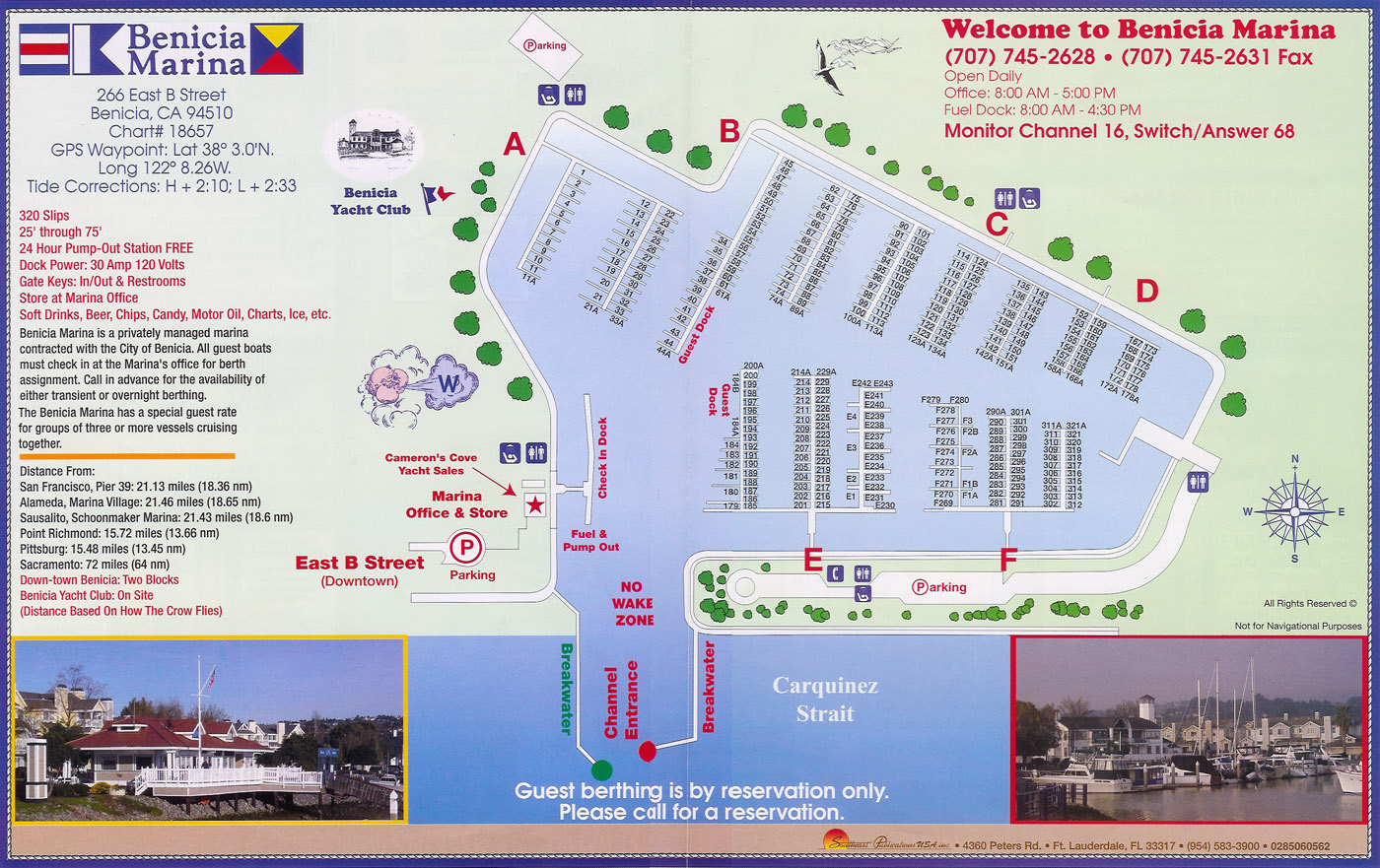
For some reason the Benicia California Marina has virtually no online presence. I've cobbled together a scan of the freebee map that the harbormaster gave away in July 2007.
Note that the Lat/Lon (GPS) coordinates on the map are a bit off. They point to a location in the middle of the 780 freeway. The harbor entrance is closer to 38.04207°N 122.15755°W (38° 2.524' N 122° 9.453' W). Of course, the prudent will double check these coordinates on a chart and the Notice to Mariners.
Also, the distance from South Beach Harbor, San Francisco, by water, is roughly 31 nm. I like the precision to the hundreds on the meaningless rhumb-line distance.
Watch for shoaling at the breakwater entrance, and at lower low water, watch everywhere. The whole basin is a bit shallow.
The restaurants in town are only a few blocks away, but note that they tend to close early, sometimes by 9pm.